Dave on Nostr: Land Information NZ hosted a couple of webinars this week and showed us the new ...
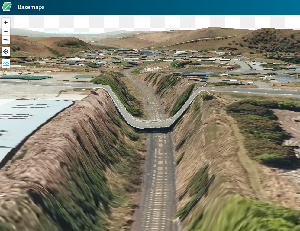
Land Information NZ hosted a couple of webinars this week and showed us the new functionality in their basemap service at
https://basemaps.linz.govt.nz. Thanks to much of the country now having LIDAR data (and a bit of fudging in the gaps with 20 metre contours) they've now got a smart new 3D terrain map.
The problem is, sometimes the LIDAR has been processed to show the underlying ground level, not the above-ground structures...

Published at
2024-08-24 08:20:24Event JSON
{
"id": "c8519afb7468a7dab10cfcef3d089c0762927729342ae7871004aefe0060b70b",
"pubkey": "5bb9fa03d689485113b778c8d8ffd9a0406f44ab9510586cbf2558025a6c31f7",
"created_at": 1724487624,
"kind": 1,
"tags": [
[
"proxy",
"https://mastodon.nz/users/Daveosaurus/statuses/113016020990942686",
"activitypub"
]
],
"content": "Land Information NZ hosted a couple of webinars this week and showed us the new functionality in their basemap service at https://basemaps.linz.govt.nz. Thanks to much of the country now having LIDAR data (and a bit of fudging in the gaps with 20 metre contours) they've now got a smart new 3D terrain map.\n\nThe problem is, sometimes the LIDAR has been processed to show the underlying ground level, not the above-ground structures...\n\nhttps://mastodon.nz/system/media_attachments/files/113/015/997/284/079/155/original/aa3dc1ac12be0d70.png",
"sig": "3fb811f84bd189212257e56937daf54c18721949c239b8eed48924ac4fb68c108d06dfe047b56a9c276c035f83fa1fd8769b457d11b7596e41e82044ae55a9aa"
}

