Event JSON
{
"id": "714934bfc31235753c3d37284718956cbd6f2a6f05f2177ab8d4c475efcbc032",
"pubkey": "58cd45254efcd9319c83e096f19f1843ca7bdb257105db25980659669deb8cd3",
"created_at": 1744279798,
"kind": 1,
"tags": [
[
"r",
"https://www.foxnews.com/tech/cutting-edge-drone-tech-maps-land-water-laser-accuracy"
],
[
"subject",
"Cutting-edge drone tech maps land and water with laser accuracy"
],
[
"published_at",
"1744279251"
],
[
"image",
"https://static.foxnews.com/foxnews.com/content/uploads/2025/04/2-high-tech-drone-maps-land-and-water-with-laser-accuracy.jpg"
],
[
"p",
"58cd45254efcd9319c83e096f19f1843ca7bdb257105db25980659669deb8cd3",
"wss://articles.layer3.news"
],
[
"imeta",
"url https://static.foxnews.com/foxnews.com/content/uploads/2025/04/2-high-tech-drone-maps-land-and-water-with-laser-accuracy.jpg"
],
[
"t",
"Tristan Allouis"
],
[
"t",
"Kurt Knutsson"
],
[
"t",
"environment"
],
[
"p",
"edf86a9d3e77a6f70e0b421df2c0e09bb13ec9f1a836d00d0cbed1bc2953a606",
"wss://articles.layer3.news"
],
[
"e",
"0e45e9e1301fca267944acdbb15cbedfd5ed7bbfdece20dca71ee600bd931b6b",
"wss://articles.layer3.news",
"root"
],
[
"q",
"0e45e9e1301fca267944acdbb15cbedfd5ed7bbfdece20dca71ee600bd931b6b",
"wss://articles.layer3.news"
]
],
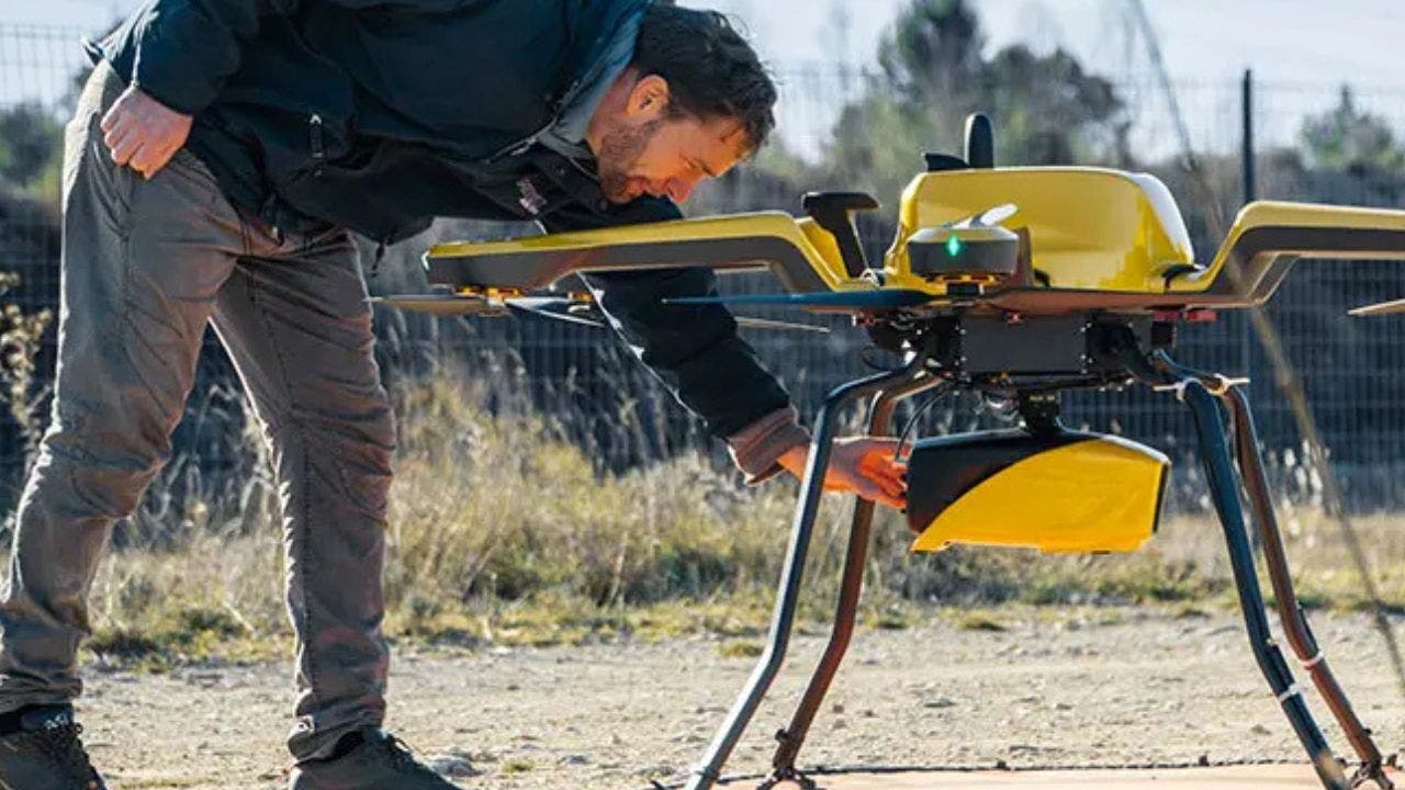
"content": "\nnostr:nprofile1qyd8wumn8ghj7ctjw35kxmr9wvhxcctev4erxtnwv4mhxqpqahux48f7w7n0wrstggwl9s8qnwcnaj034qmdqrgvhmgmc22n5crquwn0h8\n✍️ YellowScan's Navigator system uses drone-based lidar technology to map shallow waters with high precision, enabling researchers and conservationists to better understand and protect the world's waterways.\n👉 The Navigator system uses miniaturized high-precision sensor technology to map shallow waters up to 65.6 feet deep with an accuracy of approximately 1.18 inches.\n👉 It is suitable for mapping shallow waters where traditional techniques are unsafe and can produce digital models with an accuracy of approximately 1.18 inches.\n👉 The system has an integrated camera for true-color data visualization and can operate for up to 45 minutes on a single battery charge.\n👉 The Navigator system has a range of environmental applications, including tracking coastal erosion, monitoring underwater biodiversity habitats, and assessing coral reef degradation.\n\n#TristanAllouis #KurtKnutsson #environment\nnostr:nevent1qvzqqqqqqypzpm0cd2wnuaax7u8qkssa7tqwpxa38mylr2pk6qxse0k3hs548fsxqyd8wumn8ghj7ctjw35kxmr9wvhxcctev4erxtnwv4mhxqpqpez7ncfsrl9zv72y4ndmzh97ml2767almm8zph98rmnqp0vnrd4sfldazq \n",
"sig": "34235223c94f1efefe5204b468ec06b7363fc8192cde00b86ac4478f1dc8d32b51c1d7f7034f489d8a8923e72feb807ca5f077348117ef6ebd16dcbbcc2b8808"
}