Event JSON
{
"id": "be04c47215922e88726df4bb54ca297ecaeecb4fce8d85eff687b3839e6143e6",
"pubkey": "aaeea14fe500b6653d17bedf4a12e4f5ac40bf2b6297baf5db1f551a0fcae9cf",
"created_at": 1710689812,
"kind": 1,
"tags": [
[
"t",
"AppalachianTrail"
],
[
"t",
"trails"
],
[
"t",
"adventure"
],
[
"t",
"mountains"
],
[
"t",
"Forest"
],
[
"t",
"Nature"
],
[
"t",
"Massachusetts"
],
[
"t",
"LandscapePhotography"
],
[
"t",
"outdoors"
],
[
"t",
"hiking"
],
[
"t",
"backpacking"
],
[
"proxy",
"https://mstdn.social/users/GSteffanos/statuses/112111767564615083",
"activitypub"
]
],
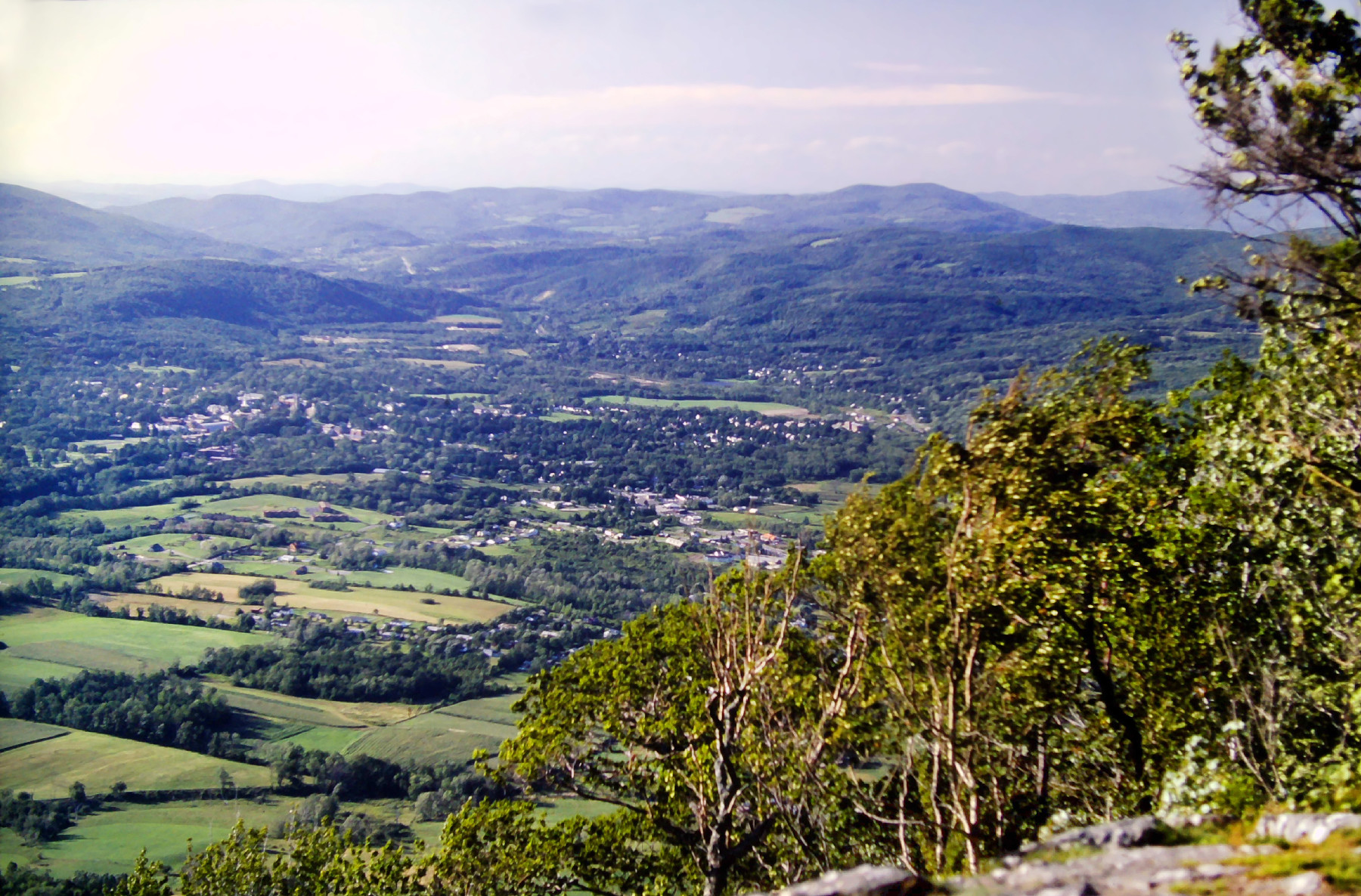
"content": "🧵 1/3\nAugust 21, 1983: After a steep scramble up a rockslide, the trail broke out of the forest onto open rocks and ledges along the ridge crest with great views southward across the valley. The neighboring large towns of North Adams and Williamstown spread out below, covering a broad, relatively flat section of that river valley.\n\n#backpacking #hiking #outdoors #landscapephotography #Massachusetts #nature #forest #mountains #adventure #trails #AppalachianTrail\n\nhttps://media.mstdn.social/media_attachments/files/112/111/736/562/487/978/original/3c2a81d459aef4d7.jpg",
"sig": "72b9d3b9031ddb088939257f9cb47b9bef728f4a5492a3a46e782a7bbc2771598d0668af849c629ff0109d17f5c90f8a53b5ecee3f4cc07358f47a7e6c5caa7d"
}
