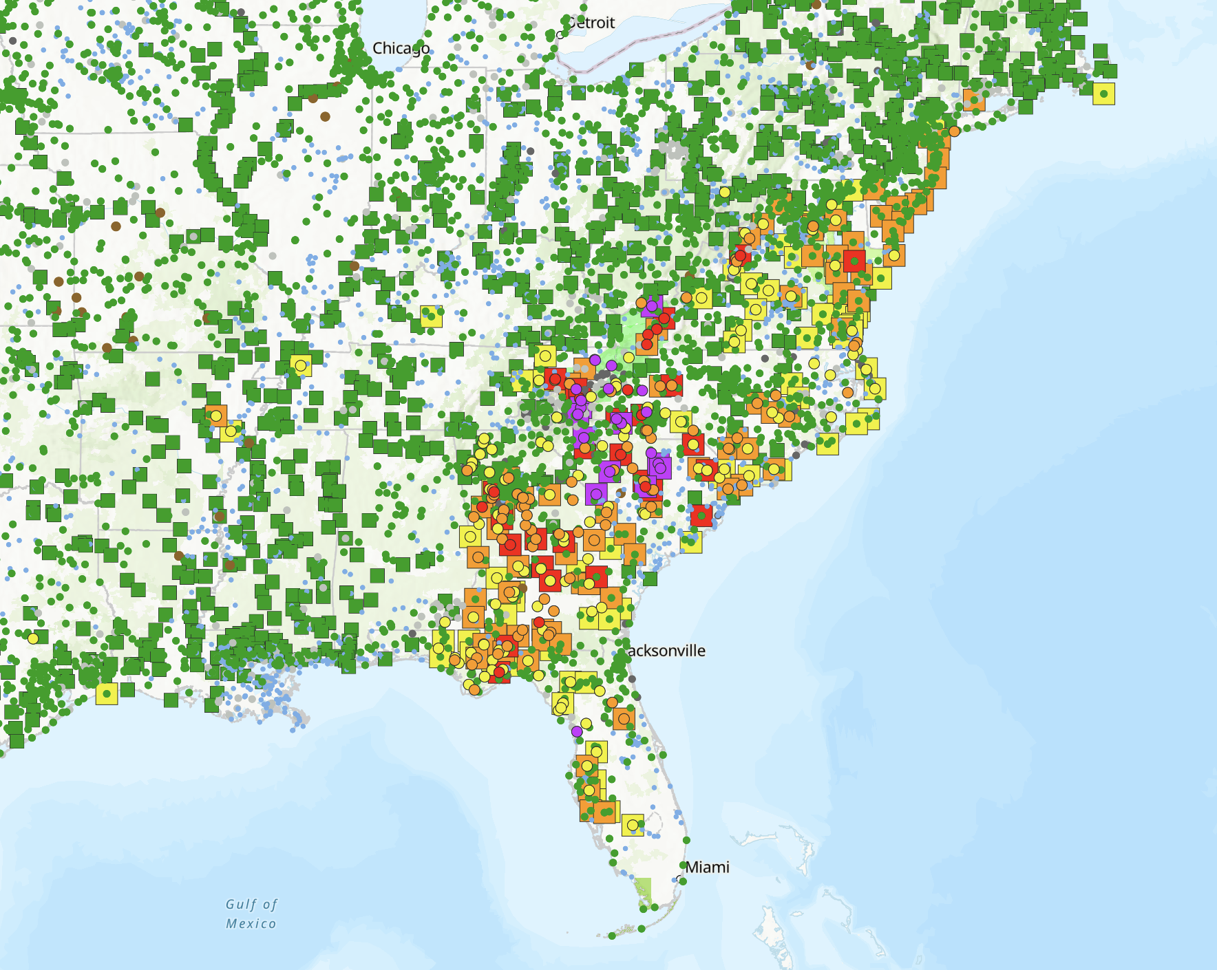
Adam Collins on Nostr: Yes, there is a free and convenient way to see how the waterways, rivers, dams, ...
Yes, there is a free and convenient way to see how the waterways, rivers, dams, lakes, etc (basically everything hydrological) are functioning within the continental United States!
NOAA provides the National Water Prediction Service which encompasses thousands of hydrological gauges, and presents them all on one convenient map, via
https://water.noaa.gov/After Hurricane Helene, this is what that map looks like (purple is very bad, grey means no longer reporting):
#Helene #NOAA #weather
Published at
2024-09-28 22:24:42Event JSON
{
"id": "bc4c8ada182566707d519d5884d2fbf721ec2553dba31c9b1aa069ae305ad5e9",
"pubkey": "edbffb51c58354eb74243b8d4095d4ab979ade59acd44e7c51e2cf37121a1a4a",
"created_at": 1727562282,
"kind": 1,
"tags": [
[
"t",
"helene"
],
[
"t",
"noaa"
],
[
"t",
"weather"
],
[
"proxy",
"https://mastodon.social/users/m104/statuses/113217521750478854",
"activitypub"
]
],
"content": "Yes, there is a free and convenient way to see how the waterways, rivers, dams, lakes, etc (basically everything hydrological) are functioning within the continental United States!\n\nNOAA provides the National Water Prediction Service which encompasses thousands of hydrological gauges, and presents them all on one convenient map, via https://water.noaa.gov/\n\nAfter Hurricane Helene, this is what that map looks like (purple is very bad, grey means no longer reporting):\n\n#Helene #NOAA #weather\n\nhttps://files.mastodon.social/media_attachments/files/113/217/504/419/754/998/original/bf33f8a2f361174a.png",
"sig": "c08e55decbe551acf861e7c1a60b26ebe9de0ad93ca76d521f14dd92d40119d83555ba7984edadc681d25fad2cf31a55cb269232f1e4506d7b860e404eb13079"
}