Event JSON
{
"id": "ba2c4d888923281bfd119f3356ac7254462cdd3528d1242c96542082cb4f62f9",
"pubkey": "8e10c71d95b93c41fb37c3ef057b75c43bf22965355da78642065f84df3065d2",
"created_at": 1745839699,
"kind": 1,
"tags": [
[
"e",
"ed595b9ef8e68edbf7f3e4fa5dfb5d9da84c46656d84dd5ff817dc10c51772d3",
"",
"root",
"8603f33faa0b328ad224d00aebea2523a6d53f6778cca5312227cd834f7bf5a1"
],
[
"p",
"068f9e02294306875b7c803bac1950cf1c39ca926a1fd9a2a44cc99688f7a549"
],
[
"e",
"b5355e4b872360dfbd8100d78d46506ae18d6f51aa8e6fd4a0d341f96f4df451",
"",
"reply",
"8603f33faa0b328ad224d00aebea2523a6d53f6778cca5312227cd834f7bf5a1"
],
[
"proxy",
"https://bne.social/@james/114415350549150163",
"web"
],
[
"p",
"8e10c71d95b93c41fb37c3ef057b75c43bf22965355da78642065f84df3065d2"
],
[
"imeta",
"url https://assets.bne.social/media_attachments/files/114/415/350/388/440/406/original/e50d7ffdac3d48e2.png",
"m image/png"
],
[
"p",
"8603f33faa0b328ad224d00aebea2523a6d53f6778cca5312227cd834f7bf5a1"
],
[
"p",
"f420b574fa3b9f4628193d5c53faba63e743161bbae69d367117097d2d238ac4"
],
[
"proxy",
"https://bne.social/users/james/statuses/114415350549150163",
"activitypub"
],
[
"L",
"pink.momostr"
],
[
"l",
"pink.momostr.activitypub:https://bne.social/users/james/statuses/114415350549150163",
"pink.momostr"
],
[
"-"
]
],
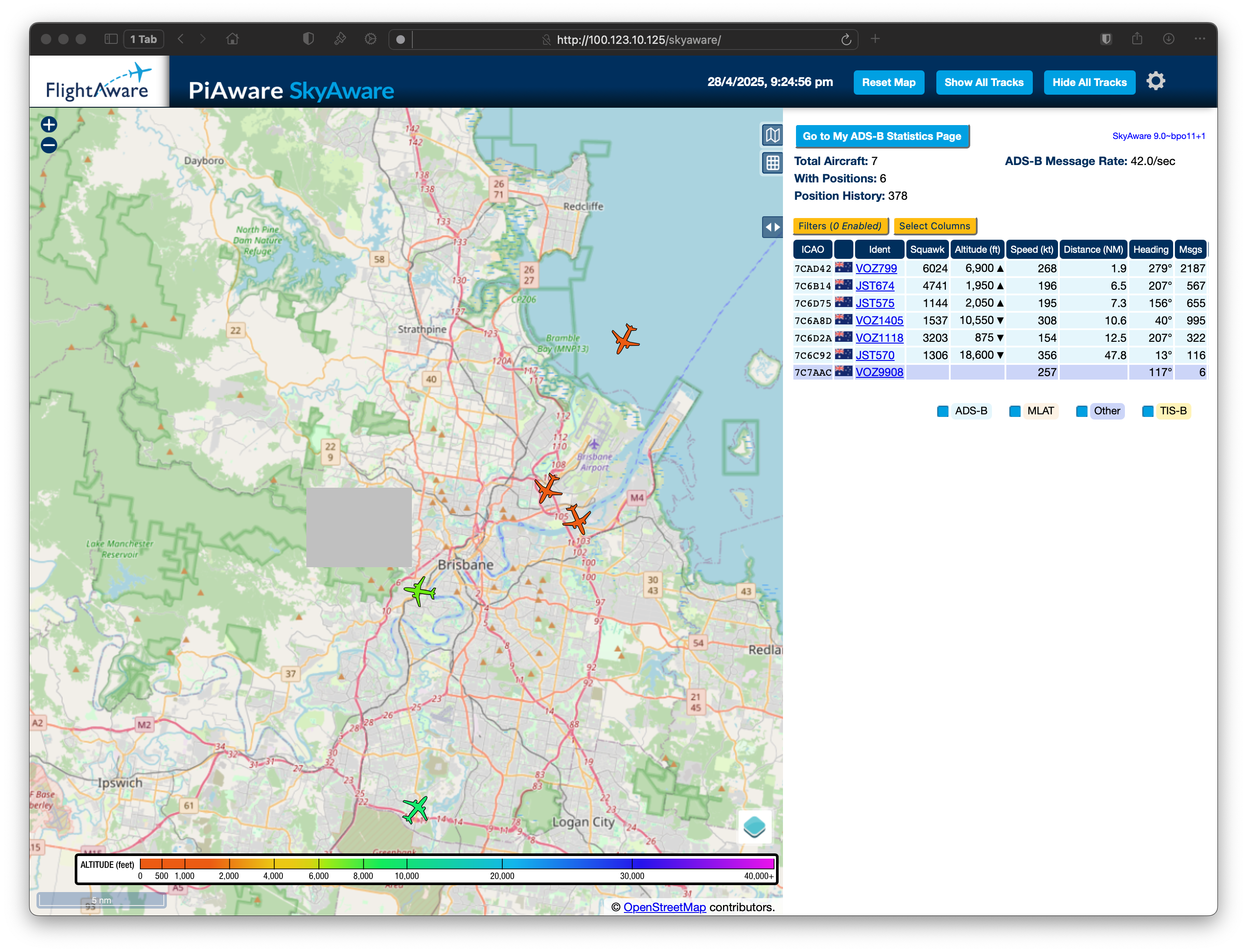
"content": "Worthwhile remembering that the coverage graph at https://www.flightaware.com/adsb/stats/user/JamesCridland is really \"where the planes are\", given the flight paths. But if it's an urban canyon, you might not see too far (except for directly overhead, which is probably all you need).\n\nI've been wanting to build a little screen showing the closest plane for a while - but I also want it to be eInk, and I don't think I can do both.\nhttps://assets.bne.social/media_attachments/files/114/415/350/388/440/406/original/e50d7ffdac3d48e2.png\n",
"sig": "ad279c645b61ddf0511260eb56c6d2467a3c00ac1a9dc93ca080f89e7eb6bed31ed7b2517d5efa885981bcdd04acf6a7b7b3b49fff0efa4f0833a58c0fe820a5"
}