Event JSON
{
"id": "09e3df513f180d564cf6e23b02c7b257e136f20150ff6a088519293ba1284852",
"pubkey": "35ca9beb10f6282bdc518bc22ac2966b915af41e372314e89f32f2db4a5a4689",
"created_at": 1710089972,
"kind": 1,
"tags": [
[
"p",
"22fe76d3b822cadb7c5ccb43ad8bacedff599d7d20a9086adf6143291b6bdcb2",
"wss://relay.mostr.pub"
],
[
"p",
"ff0737338d21e4b2be4f50e5b9683249f6a3e25e296f68c27abb455967fd8ef7",
"wss://relay.mostr.pub"
],
[
"e",
"5770087343cf2912fbfbe9ce9ceb055f874ebf776ad8cce1b5a1b4375546cbb7",
"wss://relay.mostr.pub",
"reply"
],
[
"proxy",
"https://chaos.social/users/blinry/statuses/112072456416660004",
"activitypub"
]
],
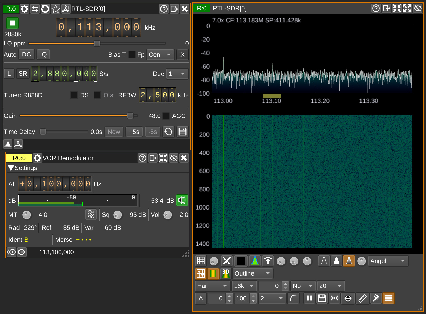
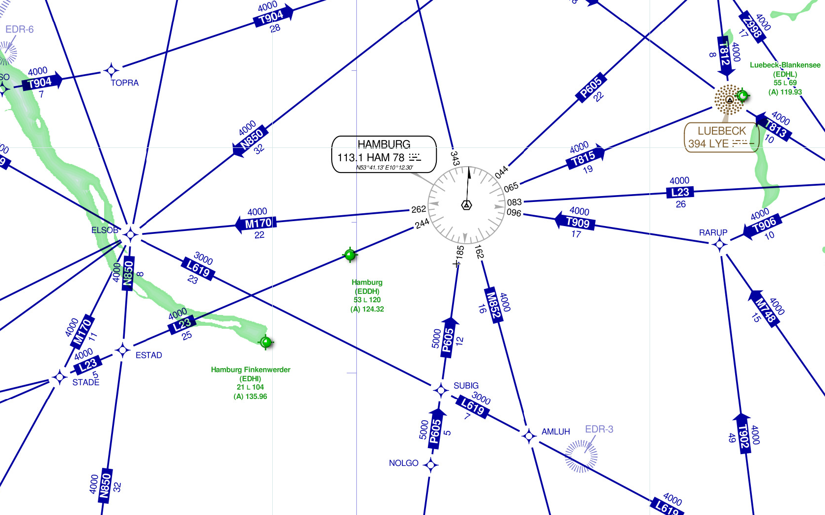
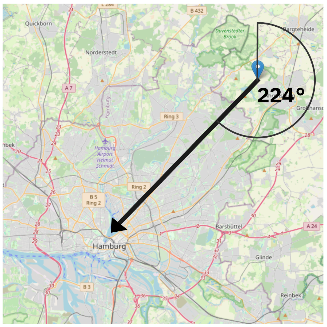
"content": "46: Receive navigational aids for airplanes\n\nThere are ground stations that emit a signal that allow calculating your angle relative to it! If you receive two, you can determine your position.\n\nI hear the one close to Hamburg! SDRangel has a decoder, of course! It outputs angles between 210° and 230°, which is pretty good! Don't think they are meant to be used from the ground.\n\nThe neat navigational map is from https://skyvector.com!\n\n(Thanks, nostr:npub1ytl8d5acyt9dklzuedp6mzavahl4n8tayz5ss6klv9pjjxmtmjeqyrae4t!)\n\nhttps://assets.chaos.social/media_attachments/files/112/072/444/750/781/074/original/5029b31e8a681a21.png\n\nhttps://assets.chaos.social/media_attachments/files/112/072/449/624/483/067/original/273232dae2961991.png\n\nhttps://assets.chaos.social/media_attachments/files/112/072/451/254/512/339/original/408727dc40cc80cc.png",
"sig": "a78dc074b501157b06e6c82ab16d5d19c39bf66cce27c77b955b37ee08c49350ea6e57493825c2eda47791e6deb94d9a2e8ced98dd342fd9944504849708edcd"
}


