Event JSON
{
"id": "9a1d57e76161a99a07662751816a8252204ad5619c3e33e50dd3e38bfcc4c6e6",
"pubkey": "4d474fbc01be3fa596ef14c5e96ea2df8030f3326fa9fafa9c10b02cee34cb00",
"created_at": 1706196339,
"kind": 1,
"tags": [
[
"t",
"nasa"
],
[
"t",
"MMGIS"
],
[
"t",
"flight71"
],
[
"t",
"flight72"
],
[
"t",
"ingenuity"
],
[
"t",
"marshelicopter"
],
[
"t",
"mars2020"
],
[
"t",
"solarocks"
],
[
"t",
"space"
],
[
"proxy",
"https://mastodon.social/users/65dBnoise/statuses/111817283328278064",
"activitypub"
]
],
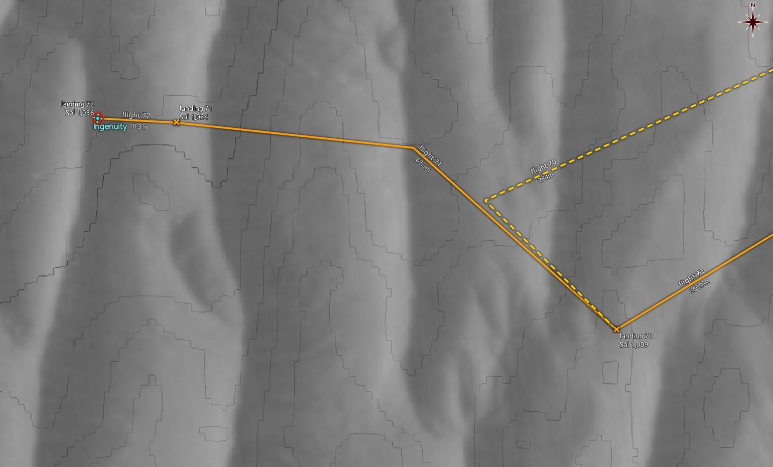
"content": "#NASA have updated their #MMGIS map which now shows the locations for both #Flight71 and #Flight72 of #Ingenuity. \n\nThere is no significant change in the visibility/radiocoverage plot between my guessed flight72 landing location and the official one.\n\n#MarsHelicopter #Mars2020 #Solarocks #Space\n\nhttps://files.mastodon.social/media_attachments/files/111/817/289/311/203/095/original/ad8162520149b7ad.jpg",
"sig": "5453e3e8b55a78c4adec3f4e6c97f764fc0795914ef0aed03b67cfbade565c920d48bceb6e0bdb5266454ca4345d75b343a07043cf033b2c45b7012783b9d07f"
}