Event JSON
{
"id": "d34978f00cb8fe89229db2f1c96e0a297a3ac3351b89ca8ec492bd0c68943913",
"pubkey": "d9759f131bdf455edfd03e4cef1b4cdf37cc606f095a6cf755cd259395645125",
"created_at": 1719041403,
"kind": 1,
"tags": [
[
"imeta",
"url https://ec.social-network.europa.eu/system/media_attachments/files/112/655/435/197/859/305/original/30e48ae3bc45e51d.jpeg",
"m image/jpeg"
],
[
"t",
"eugreendeal"
],
[
"proxy",
"https://ec.social-network.europa.eu/@EUCommission/112659097394852141",
"web"
],
[
"proxy",
"https://ec.social-network.europa.eu/users/EUCommission/statuses/112659097394852141",
"activitypub"
],
[
"L",
"pink.momostr"
],
[
"l",
"pink.momostr.activitypub:https://ec.social-network.europa.eu/users/EUCommission/statuses/112659097394852141",
"pink.momostr"
],
[
"expiration",
"1721633429"
]
],
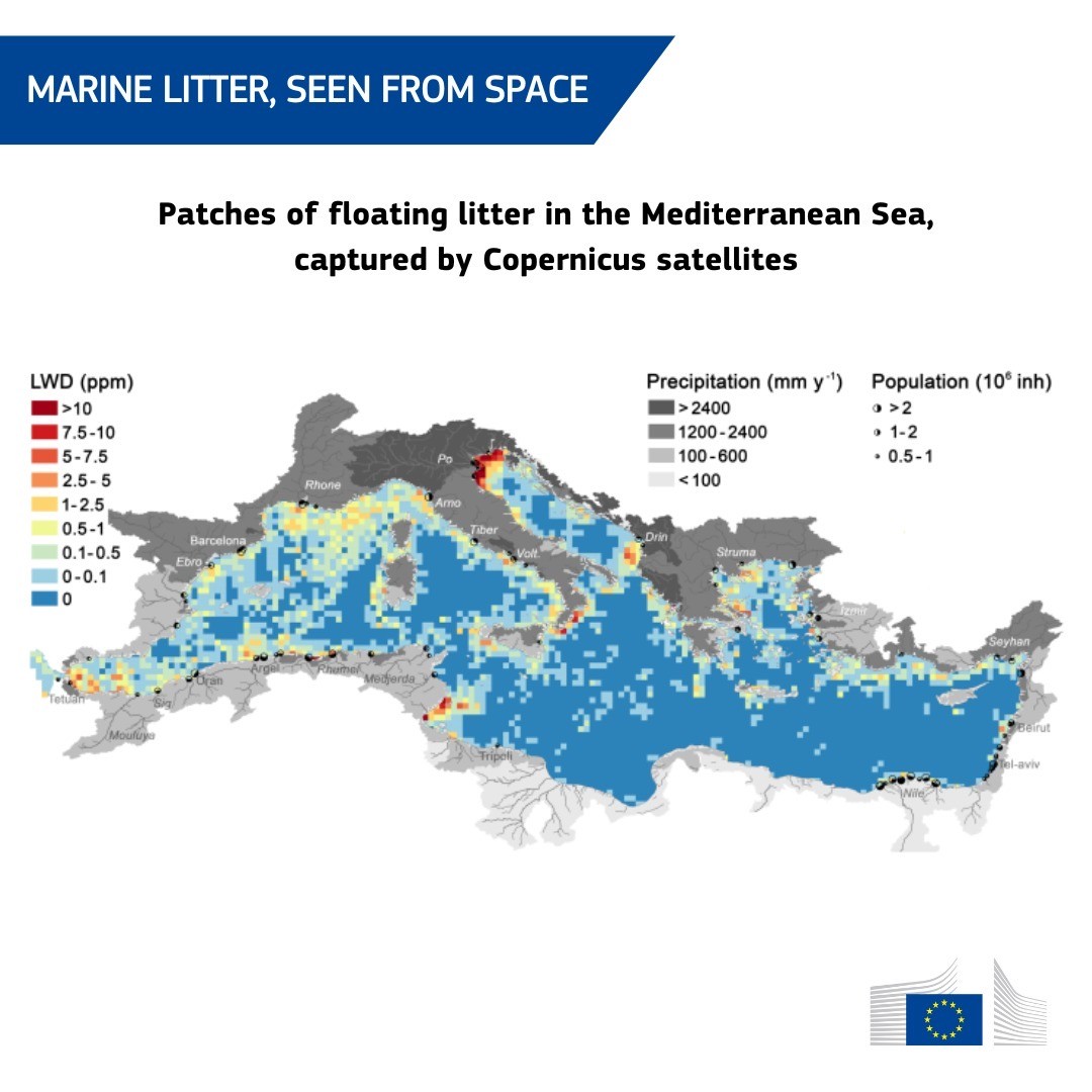
"content": "🛰️ Satellite data can be used to detect marine litter from space. \n\nScientists discovered they can use satellites to locate patches of floating litter, also called “windrows”. \n\nBy analysing images taken by Copernicus satellites, they found thousands of litter windrows in the Mediterranean Sea, ranging from a few hundred metres to 20 kilometres long. \n\nThis can facilitate clean-up operations, making our oceans cleaner.\n\nDetails: https://europa.eu/!xxpPDd\n\n#EUGreenDeal\nhttps://ec.social-network.europa.eu/system/media_attachments/files/112/655/435/197/859/305/original/30e48ae3bc45e51d.jpeg\n",
"sig": "5f1c27e78708fdd31d98aaa48bcf46bd47e32b61d466f4866f4511e5594cfacc12016f9e4eaaa74b4951660f9a810ab28385c9b721b3764bbdcbf8e2791cf2a8"
}
