Event JSON
{
"id": "fe43c6597e9a833e85f321f8c2d79bb46d04ddee5a9b86d7bbe2f00cedeaccc9",
"pubkey": "549be4eccd2d7015f6033c9df13a6ae979ee04572b5c5e059305dedd4740f886",
"created_at": 1703673648,
"kind": 1,
"tags": [
[
"p",
"d7f4cce196be922af3284c467ae25e50afefe9fa1aca689440630ec35edc2ff8",
"wss://relay.mostr.pub"
],
[
"p",
"90e48b5c681426a60c94ac6691e0ed5a4f33b949ad9cecb590c1f1d51d692318",
"wss://relay.mostr.pub"
],
[
"t",
"openstreetmap"
],
[
"proxy",
"https://fosstodon.org/users/nicemicro/statuses/111651956258888825",
"activitypub"
]
],
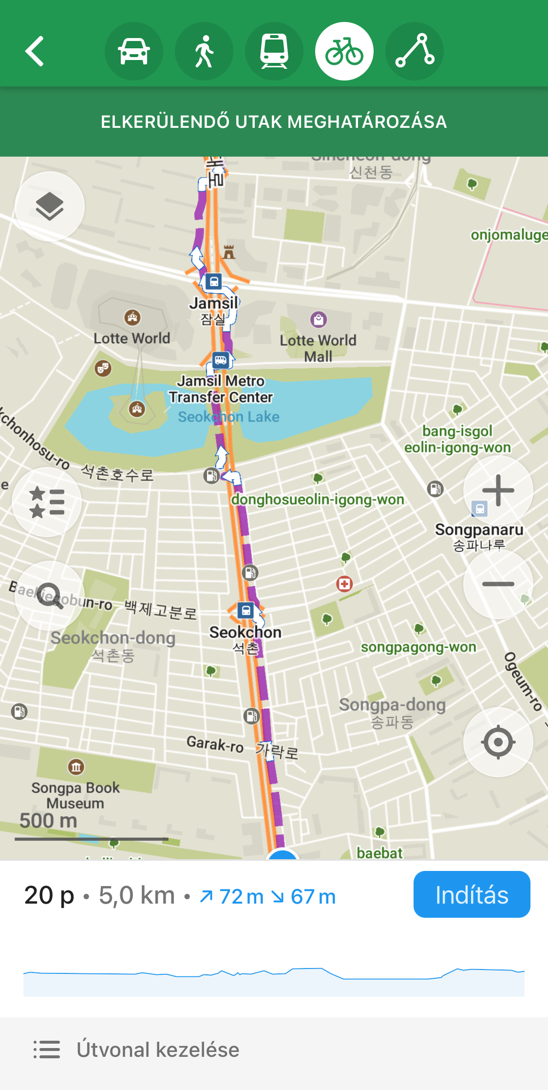
"content": "hi nostr:npub16l6vecvkh6fz4uegf3r84cj72zh7l606rt9x39zqvv8vxhku9luqss4zxy, I have mapped the sidewalks (with bike paths) around one of the largest avenues in Seoul, Songpa-daero in #openStreetMap \n\nWhen I plan a cycle route along this road however, the app makes some weird decisions, like crossing from left to right side multiple times, sometimes not even on the crosswalks.\n\nDid I use an improper tagging scheme? or did I create some edge case the app is not prepared for?\n\nThis area:\nhttps://www.openstreetmap.org/#map=16/37.5114/127.1020\n\nhttps://cdn.fosstodon.org/media_attachments/files/111/651/945/533/658/376/original/7e135db02ab84152.png\n\nhttps://cdn.fosstodon.org/media_attachments/files/111/651/945/552/531/273/original/dcde106c5e3b6226.png",
"sig": "40c693a0642627484ba1aa23a0073e8747538ac85e5e98f9da5102649af258f646f5427c8f196cad3e3a24a44a16647473588414c28f6e06657d9b7c245922fa"
}